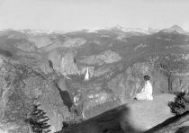
Glacier Point
Distance: 1 mile (1.6 km) round trip
Elevation at trailhead: 7,200 feet (2,200 meters)
Elevation Gain: none that you'd notice
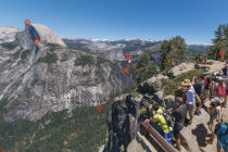
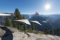
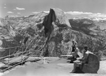
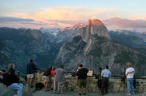
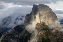
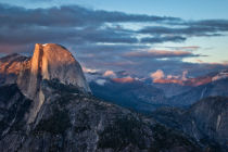
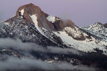
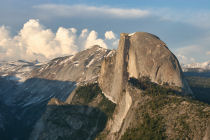
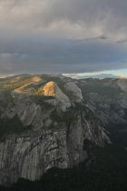
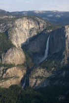
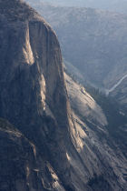
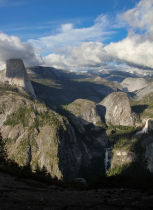
Why See Glacier Point? The views from here, which include Yosemite Valley in a sheer drop beneath you, the iconic shape of Half Dome looming just across the gorge, and the Sierra crest punctuating the eastern horizon, are comparable to anywhere on the planet.
Hiking Time: 20 minutes
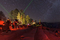
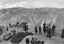
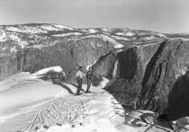
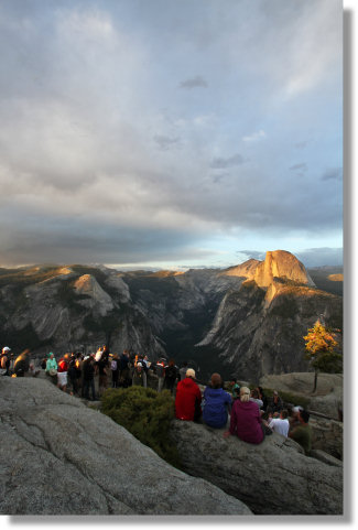
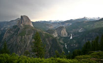
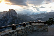
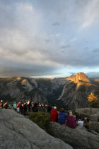
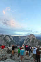
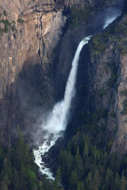
Best Time to Visit: Crowds are low from November to May. You'll need cross-country skis to get here then, though, because Glacier Point Road is closed during these months. Otherwise, anytime the road is open is a fabulous time to be at Glacier Point. Sunsets, in particular, rock. Springtime gets a slight edge over the rest of the year because of the views looking down on Vernal and Nevada Falls at full runoff.
Crowd Factor: High when Glacier Point Road is open. It's a short, easy hike with gasp-inducing views as a reward, so it draws a crowd. If you want similar, but slightly more secluded views, try hiking to Sentinel Dome or Taft Point instead. Dewey Point, farther west, is even less crowded - in fact, it might be the only trail in Yosemite that's arguably less crowded in the summer than in the winter, when it's a major destination for snowshoers and cross-country skiers. Washburn Point, which you'll pass three quarters of a mile before reaching Glacier Point, is also typically less crowded and a must stop.
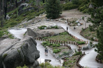
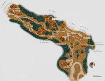
Difficulty: One of Yosemite's easiest hikes. Much of it is wheelchair accessible (see the trail map for the wheelchair route to the point).
Getting There: Glacier Point can be found, logically enough, at the terminus of Glacier Point Road.
From the South entrance to Yosemite, turn left and travel 17 miles (28 km) to Glacier Point Road. From Yosemite Valley, find the highway 41 valley exit and take it nine miles (14.5 km) to the same road.
Once you're on Glacier Point Road, just follow it all the way to its end at the Glacier Point parking lot 16 miles (26 km) later. Here's a Google Street View panorama of the trailhead area.
Parking: There's a large parking lot at the trailhead. It occasionally fills up, but if you do a loop or two around the lot, something will likely open up. If you're a rain god and can summon thunderheads at will, that should speed things up.
Nearest Bathrooms: Scattered throughout the parking lot, all pit toilets. It's common to find lines three or four deep at the outhouses closest to the trailhead and nobody using the toilets towards the back of the lot, where I usually park because it's handy to the food-storage lockers. Bathrooms with plumbing right at the trailhead have been closed for years, reportedly because the area is too rocky to create a sufficiently large leach field.
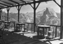
Nearest Snacks: Gift shop and cafeteria at the trailhead. Closed during winter months, though. Open 9 am - 7 pm during the summer.
Food Storage Lockers: At the far end of the parking lot.
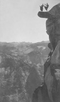
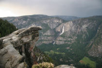
Hazards: Stay on the uphill side of the stone retaining walls if you care to stay alive to see another sunset tomorrow. And give the hanging rock a miss, too, if you don't include flying or bouncing among your super powers.
Already been to Glacier Point? Add a Review.
Glacier Point Highlights
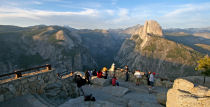
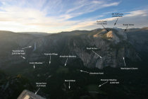
Glacier Point Panoramas
From Virtual Yosemite