Stanislaus National Forest Campgrounds - Highway 120 Area
View Stanislaus NF Campgrounds in a larger map
The forest service maintains nine campgrounds along the Highway 120 corridor between Groveland and Yosemite. They're a bit less refined than Yosemite's campgrounds, lacking plumbed toilets or sinks. They do all have pit toilets, and most of them have potable water available at outdoor faucets. None have showers.
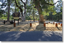
For Yosemite-bound visitors, the Dimond O (see '1' on the above map) is probably the best option. It's not only the closest to the park's Highway 120 entrance, but it's also only 2.5 miles (4 km) from the Hetch Hetchy entrance and a mile from the Evergreen Lodge, which has a restaurant, bar, general store, and bathrooms. Summer visitors can buy $10 day-use passes for Camp Mather, a mile and a half away, which has a swimming pool, lake, tennis courts, and a beach volleyball court.
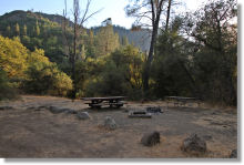
The Lumsden, South Fork, and Lumsden Bridge Campgrounds (see '6' on the map) are the obvious bargains in the group, and they're along the Tuolumne River to boot. However, they don't have potable water, and getting to them requires a mildly harrowing 5-mile (8 km) descent to the canyon floor via Lumsden Road, which is unpaved, occasionally rutted, and only intermittently wide enough for two cars to pass each other. Four-wheel drive isn't necessary during good weather, but a certain amount of nerve is, and trailers aren't recommended. The road gets rougher after you pass South Fork, the second of the three.
| Name | Distance from Yosemite Miles (Km) |
Rates | # sites | Potable Water | Other |
|---|---|---|---|---|---|
| 1. Dimond O | 7 (11)1 | $26/$52 | 36 | Yes | Reservations; open May - September |
| 2. Cherry Valley | 35 (56) | $24/$48 | 45 | Yes | First-come, first-served; 22' max vehicle length; open May - September |
| 3. Sweetwater | 10 (16) | $16/$22 | 12 | Yes | First-come, first-served; open May - September |
| 4. Lost Claim | 13 (21) | $19 | 10 | Yes | First-come, first-served; not recommended for trailers; open May - September |
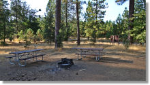
| 5. Pines | 15 (24) | $16/$21 | 11 | Yes | First-come, first-served; 4 pit toilets shared with Pines Group Campground; open year-round |
| 5. Pines Group | 15 (24) | $90 | 2 | Yes | First-come, first-served; 4 pit toilets shared with Pines Campground; open year-round |
| 6. Lumsden | 22 (35) | Free | 10 | No | First-come, first-served; not recommended for trailers; 2 pit toilets; open year-round |
| 6. South Fork | 22 (35) | Free | 8 | No | First-come, first-served; not recommended for trailers; 1 pit toilet; open year-round |
| 6. Lumsden Bridge | 23 (37) | Free | 9 | No | First-come, first-served; not recommended for trailers; open year-round |
1 Distances listed are from the Big Oak Flat (Highway 120) entrance; The Dimond O Campground is also 2.5 miles (4 km) from the Hetch Hetchy entrance.
Directions:
1. Dimond O Campground: It's on Evergreen Road (the road to Yosemite's Hetch Hetchy entrance), which is a mile west of the Highway 120 park entrance and 12 miles (19 km) east of Buck Meadows. After turning onto Evergreen Road, you'll reach the Dimond O in just under 6 miles (10 km). Another mile past the campground is the Evergreen Lodge, and another 1.5 miles (2.5 km) past the lodge is the Hetch Hetchy entrance.
2. Cherry Valley Campground is on the southern shore of Cherry Lake, around 20 miles north of Highway 120. Turn north on Cherry Lake Road, which is 10 miles (16 km) west of the Yosemite Highway 120 entrance, and just over 2 miles (3 km) east of Buck Meadows. The turnoff is just east of a bridge over the Tuolumne River. Once on Cherry Lake Road, you'll reach Cherry Lake in just over 23 miles (37 km). The road terminates at an intersection here; turn left (the intersection is signed) and you'll reach the campground turnoff in just under half a mile.
3. Sweetwater Campground is on Highway 120, 10 miles (16 km) west of the Yosemite entrance and 3 miles (5 km) east of Buck Meadows.
4. Lost Claim Campground is also on Highway 120. It's just east of Buck Meadows, a quarter mile or so, and just under 13 miles (21 km) west of the Yosemite entrance.
5. The Pines and Pines Group Campgrounds: The signed turnoff is along Highway 120 roughly 8 miles (13 km) east of Groveland, 2 miles (3 km) west of Buck Meadows, and 15 miles (24 km) west of the park entrance. If you're arriving from the west, it'll be just after you pass the Groveland Ranger Station Headquarters. After turning, you'll reach the campgrounds in just over a quarter mile. You can also reach them by turning at the aforementioned ranger station and continuing along the side road for just under half a mile past the station. The two campgrounds are separated by - well, nothing at all, really; they're just listed as separate campgrounds for inscrutable reasons of bureaucratic convenience. They share the same pit toilets and water source.
6. Lumsden, South Fork, and Lumsden Bridge Campgrounds: From Highway 120, turn north on Ferretti Road, which is roughly 7 miles (11 km) east of Groveland, 3.5 miles (5.5 km) west of Buck Meadows, and 16.5 miles (26.5 km) west of the park entrance. It's also just west of the signed turnoff for the Groveland Ranger Station Headquarters.
Once on Ferretti Road, drive a mile (1.5 km) to Lumsden Road and turn right. From here, you'll descend 5 miles (8 km) down the narrow, unpaved road to Lumsden Campground, which is at the bottom of the Tuolumne River Canyon. South Fork Campground is half a mile past Lumsden, and Lumsden Bridge Campground is another mile past South Fork. The road, which doesn't inspire confidence to begin with, gets increasingly rugged after passing the South Fork Campground.