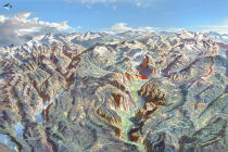
Happy Isles
Distance: 0.5 miles (0.8 km) round trip from trailhead;
2.5 miles (4 km) round trip starting from
Curry Village
Trailhead Elevation: 4,000 feet (1,220 meters)
Elevation Gain: Practically none
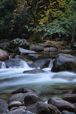
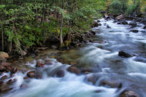
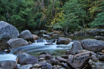
What's Happy Isles? It's a pair of islands in the Merced River at the east end of Yosemite Valley near the Mist Trail trailhead. Word is they're happy.
Why hike the Happy Isles trail? If your own personal happy place is the bar at the Ahwahnee Hotel but your conscience compels you to complete at least one hike before you go, Happy Isles will be one of the most efficient ways to dispense with that requirement. It's also pretty and generally tranquil, though not especially memorable by Yosemite standards.
Best Time to Visit: In the late summer and fall, when the lower water levels provide a more tranquil atmosphere. If you want to get into the Art & Nature Center, you'll have to show up sometime from April through October.
Crowd Factor: Usually not oppressive - the scenery doesn't merit big crowds - but steady. Skinnydipping will not go unobserved.
Lack of Difficulty: Nearly absolute. If your friends stop to use the bathroom at the trailhead, you can knock off the entire trail before they finish. Maybe twice, depending on how much of a hurry each of you are respectively in.
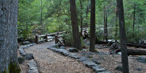
Wheelchair Friendly? Much of the trail is paved, although the bits across the river on the actual Happy Isles are not.
Nearest Bathrooms: Bathrooms with plumbing at the start of the hike.
Nearest Snacks: At Curry Village, 3/4 of a mile west.
Trail Notes: The Art & Nature Center (see the trail map) houses a collection of kid-oriented natural history exhibits and the Yosemite Conservancy's art program, which offers art classes when the center's open (April through October). The Rockfall Exhibit (again, see the trail map) is a series of placards discussing rocks and their distressing tendency to fall in great masses in the Happy Isles area.
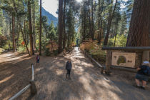
See this Google Street View panorama for a southish-facing view of the trailhead. Visible here, from right to left, are the shuttle bus stop (stop 16 on the shuttle map), bathrooms, and the now-closed snack shop, plus a trail sign that you can inspect more closely on the trail map page.
Already done this hike? Add a Review.
Happy Isles Highlights
Happy Isles Panoramas
From Virtual Yosemite
Yosemite Nature Notes #10: Rock Fall
For a brief stretch of Northside Drive near El Capitan, cars aren't allowed to stop. It's a bit like the moving sidewalk that takes you through the jewel room in the Tower of London, and for the exact same reasons, but with the parties on opposite sides of the verb: whereas the British wish to restrain you from disturbing the crown jewels, Yosemite management wants to keep pieces of the park system's crown jewel from disturbing you, primarily by dropping out of the sky onto your car and crushing it. Rockfall, for anyone standing near the valley walls, is a matter not far from the top of the mind (and if they're unlucky, the bottom of the mind, the neck, and various innards, sequentially), and Happy Isles experienced a particularly large one in 1996: