Olmsted Point
Distance: 0.25 miles (0.4 km) round trip
Elevation at trailhead: 8,300 feet (2,500 meters)
Elevation Gain: 100 feet (30 meters)
Hiking Time: 15 - 30 minutes
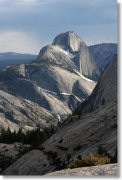
Why visit Olmsted Point? Because this is where Clouds Rest, which normally plays Felix Leiter to Half Dome's James Bond, gets its closeup.
Best Time to Visit: It's complicated. Fill out this questionnaire to find the best time for you.
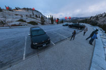
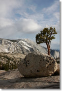
Crowd Factor: You'll find at least as many people in the parking lot as at the end of the trail; the parking lot may actually have more interesting views, with lots of striking glacial erratic boulders lounging on the hillsides there.
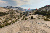
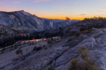
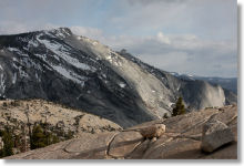
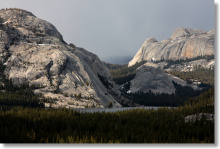
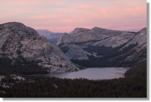
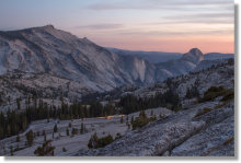
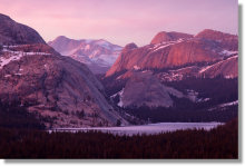
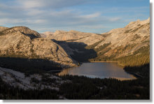
Scenery Factor: High for the amount of hiking involved. Looking west, you'll see a closeup view of Clouds Rest, with Half Dome beyond. Looking east, you'll see Tenaya Lake and the granite domes that envelop it. And the Olmsted Point parking lot itself is an interesting stop, with its surrounding slopes dotted with glacial erratics.
Difficulty: Easy; 1 out of 10. Check out the satellite view: any hike short enough that you can measure it in car lengths can't be too tough.
Parking: Large lot at the trailhead that rarely fills up; if it does, there are a few spots along the shoulder where you can park. Here's a Google Street View panorama of the parking area.
Nearest Restrooms: At Tenaya Lake, 1.5 miles (2.4 km) east
Nearest Snacks: At the Tuolumne Meadows Grill & Convenience Store, 10 miles (16 km) east
Getting There: From Yosemite Valley, take highway 120 ten miles (16.8 km) to the Crane Flat turnoff onto Tioga Road, then take Tioga Road 30 miles (48 km) east to the Olmsted Point parking lot. From Yosemite's east entrance at Tioga Pass, take the Tioga Road west 18 miles (29 km) to the lot.
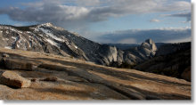
Bonus Hike: If you're not needed back at your cot right away, try hiking up the dome across the road from Olmsted Point, as Bret suggests in the hike reviews. You can reach the top in 10 minutes or so, and from there you can see - well, the same stuff you see at Olmsted Point, for the most part, but from a more regal perspective that makes you feel like you've earned your views, while the uninitiated rabble down in the parking lot remain mere tourists. The dome narrows to a ridge at the top, and though going over the side here is more likely to be painful than fatal, acrophobes and people known to be in charge of small children should approach with caution.
The view east to Tenaya Lake from the top is partially obstructed by a tree that has elected to grow horizontally across the ridge, but if you clamber over the tree, you'll find the ridge continues beyond it, and in fact proceeds all the way to the next mountain over. If you hike over to this next peak and continue along the back side of it all the way to the eastern slope, you'll pass several sights of varying interest, including the view back to the dome you just climbed, a seldom seen perspective of Mt. Hoffmann, a glimpse of the northern peaks that are one of the highlights of the Ten Lakes trail, and a direct view across the valley to Tenaya Lake.
Bonus hike bonus: My experience to date suggests you may be able to get cell phone reception once you get partway up the dome. There are certainly worse views you could spray with UHF waves while you check your email.
The Olmsted Bottleneck: If Tioga Road opens behind schedule next summer, blame Olmsted Point. The avalanche risk here makes this one of the most dangerous parts of the road to clear and usually one of the last areas to be passable. In this NPS video of a snowplow crew at work clearing the Olmsted Point area, the surrounding mountains appear to already be bare (though the Tioga Road didn't open for another three weeks after the video was shot).
Already been to Olmsted Point? Add a Review.
Olmsted Point Photos

Views from the Dome Across the Road
Olmsted Point Panoramas
From Virtual Yosemite