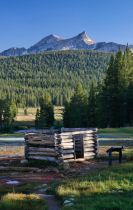
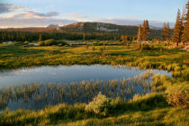
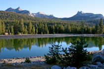
Tuolumne Meadows
Distance: 2 miles (3.2 km) more or less; it depends on how much wandering you want to do
Elevation at trailhead: 8,500 feet (2,550 meters)
Elevation gain: none to speak of
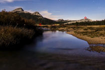
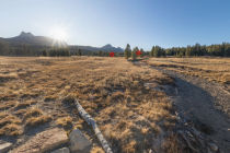
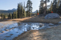
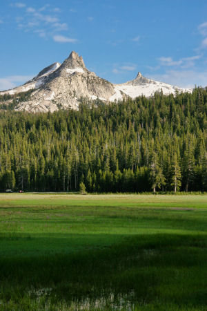
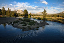
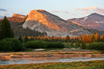
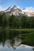
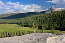
Why visit Tuolumne Meadows? There's just something about a meadow that's good for your blood pressure. And this is one of the great meadows, nearly two miles (3.2 km) long, with a river (the Tuolumne) winding through it and a variety of picturesque granite peaks and domes surrounding it.
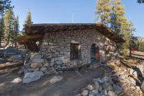
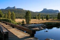
Virtual Yosemite has several panoramas of the Tuolumne Meadows area to help give you an idea of what you'll find here, including a nighttime view and a panorama of the historic Parsons Lodge. Google Street View hosts various additional panoramas worth sampling, including an oxbow bend in the Tolumne River along the central trail, the view from the bridge near Soda Springs, a view of the bridge from downstream, the Pacific Crest Trail as it passes along the north edge of the meadow, and, for a change of pace, water bubbling up at Soda Springs.
Best Time to Visit: It's pretty whenever you can get there, but it's especially striking early in the season, when the meadow is oh-so-green and full of wildflowers. And early comes later to Tuolumne Meadows than it does to the foothills or Yosemite Valley, so even if you overhibernated, there's still a good chance you can catch spring in Tuolumne Meadows.
Crowd Factor: It's a popular spot, but it's big, too, so you won't be elbow to elbow with your fellow blissed-out wanderers.
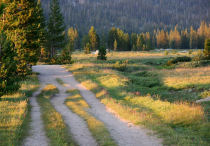
Difficulty: Tuolumne Meadows is an easy stroll; it rates a 1 or 2 out of 10, depending on how far you choose to go. About the only way to make this difficult is to turn Tuolumne Meadows into your running trail (it's a great place for a run, by the way); you'll soon realize that you're above 8,000 feet.
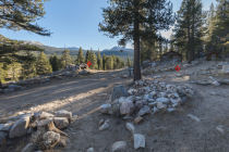
Parking: There's a fairly large lot just east of the central trailhead - look for the "Parsons Lodge" sign. Here's a Google Street View panorama of the trailhead. It predates the parking lot construction, but if visualizing parking lots is your thing, just picture it a little bit farther down the road on the right.
Food Storage Lockers: At the parking lot
Nearest Restrooms: At the visitor information center, across the road from the meadow
Nearest Snacks: At the grill & convenience store near the east end of the meadow
Getting There: From Yosemite Valley, take highway 120 ten miles (16.8 km) to the Crane Flat turnoff onto Tioga Road, then take Tioga Road 38 miles (61 km) east to reach the meadows. From Yosemite's east entrance at Tioga Pass, take the Tioga Road west 8 miles (13 km) to the meadows.
Hazards: In wet, marshy years, enter the meadow in the evenings without mosquito repellent at your own peril. You might also find things nippy if you hang out near the river, especially where it pools up near the west end of the meadow.
Tuolumne Meadows Highlights

Tuolumne Meadows Panoramas
From Virtual Yosemite