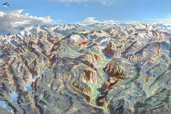
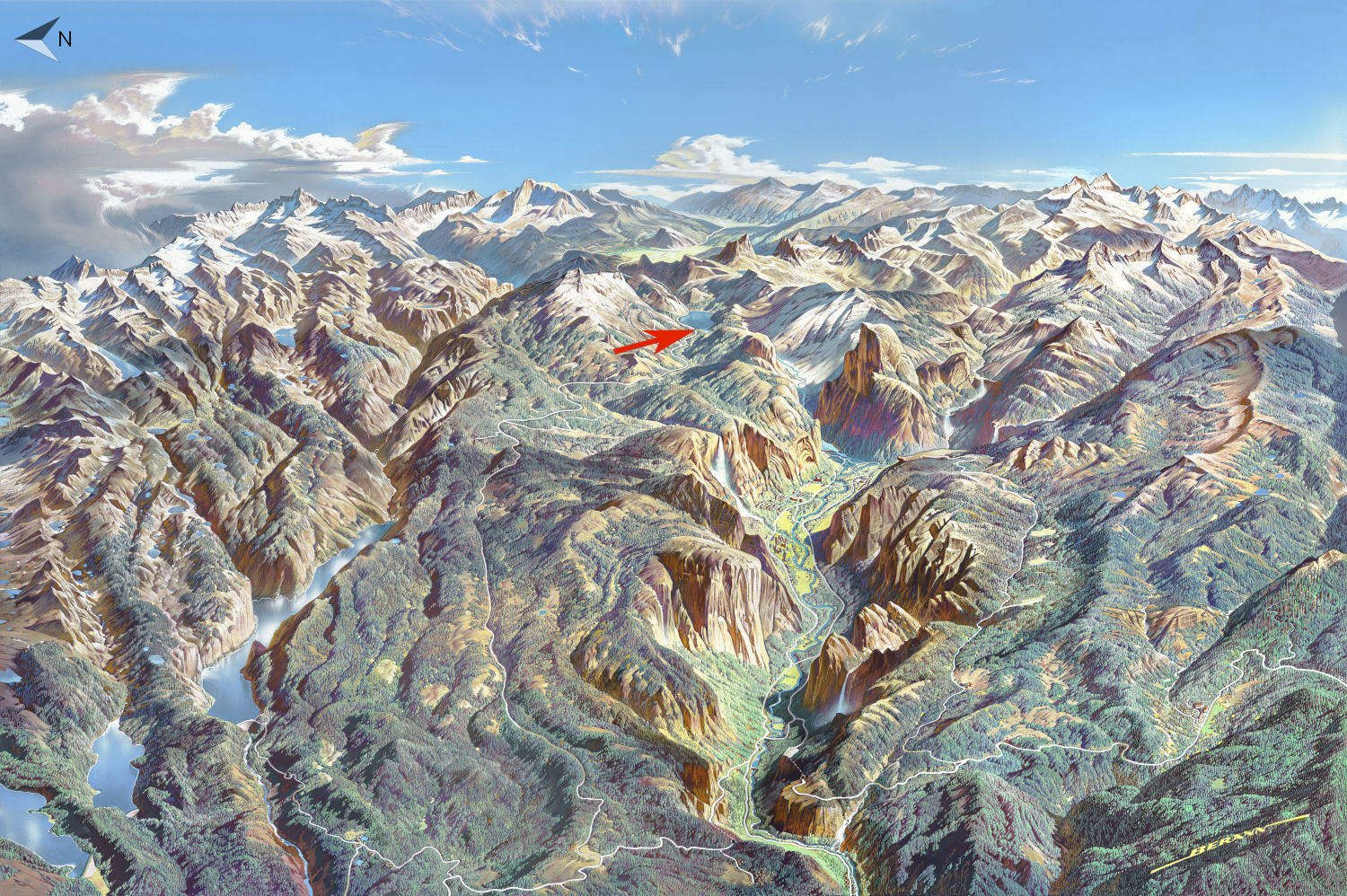
Tenaya Lake Trailhead Location
Original artwork by Heinrich Berann
The Tioga Road runs along the north edge of Tenaya Lake, so technically you can start hiking the loop trail anywhere you're able to find a parking spot. But the big red hiking arrow points to the western shore here because that's where the best views are, looking east across the lake and beyond to the sturdy sorts of mountains that were able to survive the Tioga glaciation, which peaked around 20,000 years ago but has left behind widespread signs of its passage. The eastern shore boasts Yosemite's largest beach, which has attractions of its own, but the views across the lake from there are less impressive.
If clicking on the map doesn't pop up a larger version, as will likely be the case if you're on a mobile device or other small screen, here's a larger version (500k download).