Westfall Meadow
Distance: 2.8 miles (4.5 km) round trip
Trailhead Elevation: 6,900 feet (2,100 meters)
Elevation Change: 100 feet (30 meters)
Hiking Time: 1.5 - 2.5 hours
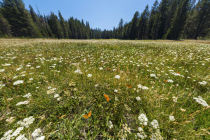
Why hike to Westfall Meadow? Westfall could readily have been christened Misanthropist Meadow; due to its unmarked trailhead, it's one of your best chances to have a Yosemite meadow all to yourself with only a couple miles of hiking, and it's larger than the immediately visible sections of Summit, McGurk, or Mono Meadows, its companion meadows along the Glacier Point Road.
Difficulty: It's an easy trail with little climbing; call it a 2 out of 10. Unless the park service has been doing trail maintenance lately, you may find one or two immense logs across the trail presenting tricky over-or-under conundrums.
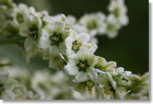
Best Time to Visit: During wildflower season, which runs roughly through June and the first half of July. If you're drawn to accident scenes and have lately found yourself pausing involuntarily in front of coffin warehouses and bringing up the rear of every funeral you meet, you might prefer it here in autumn instead. It's certainly a superior therapy to shipping aboard a whaler with a one-legged captain. What would you even call someone who'd do that, anyway?
Crowd Factor: Light. Ultra-light. Carbon-fiber light. That's the glory of unmarked trails.
Nearest Bathrooms: There's an outhouse along the road a mile west at Summit Meadow. If, like many of the occupants of Westfall Meadow, you're a delicate flower, you can find bathrooms with plumbing 7.5 miles (12 km) west at Chinquapin, the intersection of Highway 41 and the Glacier Point Road.
Nearest Snacks: Eschew the berries along the trail and drive instead to the cafeteria & store at Glacier Point, 8 miles (13 km) east.
Getting There: Your first task is getting to Glacier Point Road. From Yosemite Valley, take Highway 41 south for 9 miles (14.5 km) to the road. From the park's southern entrance, take Highway 41 seventeen miles (28 km) north.
From Glacier Point Road, drive east 7.5 miles (12 km) to the trailhead. The trailhead is unmarked, but it's directly across the road from the McGurk Meadow trailhead, which is marked - so watch for the "McGurk Meadow" sign. It'll be about two miles past the Badger Pass turnoff. If you reach the Bridalveil Creek Campground, you've just passed it.
Parking: Large lot with around 40 spaces across the road just east of the trailhead.
Food Storage Lockers: In the parking lot.
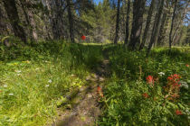
Trail Notes: The trailhead, as mentioned above, is unmarked, but it's directly across the road from the McGurk Meadow trailhead. Find it (the "McGurk Meadow" sign is an excellent clue), cross the road, and you should spot the trail.
Two-thirds of a mile into the hike, you'll pass another trail. Keep going straight. Turning left will take you to the Bridalveil Creek Campground, and turning right will take you to Badger Pass.
There's a small stream you'll have to cross along the trail. Unless it's early in the year and it's been an unusually snowy winter, you should be able to cross without any worries.
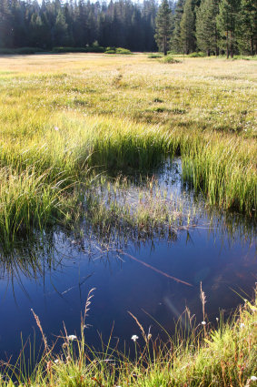
Though the trail ostensibly continues past Westfall Meadow to various distant points, including Empire Meadows and Wawona, it appears to lose its concentration and dribble into oblivion once you enter the meadow. There's a tall metal fencepostish marker where the trail enters the meadow. Note it and keep it in mind; if you decide to explore the meadow, which is nearly half a mile long, you may never be able to find the trail again without this trail marker to point the way. The park service would like to remind you that if you do explore the meadow, please avoid trampling the flora (and the fauna, too, for that matter).
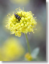
Westfall Meadow Residents

Westfall Meadow Panoramas
From Virtual Yosemite