Should I Hike the Mist Trail Today?
It depends. If the Merced River's flowing at 5 cfs (cubic feet per second), which is not at all uncommon in the autumn, the views may underwhelm you. At 3,000 cfs, sections of the overlook above Vernal Fall will be flooded and the mist will be so thick below the fall that if you can't see without glasses, you'll be more or less blind. But there's a wide range of good conditions, and the waterfalls will be memorable at flow levels down to a hundred cfs, at least, which can last well beyond the April - June peak runoff.
"So," you may be thinking - or at least you're supposed to be thinking, by the time you get to this paragraph - "that's fine, but how much water is flowing over the waterfalls right now?" This turns out to be an excellent question that the USGS has been waiting for you to ask since 1915, when they first erected a gauging station downstream from the falls at Happy Isles and - this might have been a few years later - started posting regularly updated flow numbers on the internet. Given sufficient harmony between your browser and the USGS API, the current discharge level should be showing up below (it might take a few seconds to load):
< Trying to load current water levels here... >
If something's amiss, you can still get the current level by clicking on this link and scrolling down to the "Discharge, cubic feet per second" section. The current flow is also listed on the status bar at the bottom of the Happy Isles webcam during daylight hours. In addition to this and various other data, the USGS provides monthly flow averages for the past hundred years. 1982-83 was clearly a hellacious winter, leading as it did to an average flow of 3,317 cfs in June of 1983. And astonishing as that may sound, on January 2, 1997, during a historic flood (video here) caused by a snowpack-melting warm storm, the Happy Isles gauge reached 9,000 cfs.
Assuming the Merced's water levels meet your aesthetic requirements, you'll also want to check the weather and whether or not the trail's open. The mist that gives the trail its name coats it with ice once the weather turns cold, so the Mist Trail is usually closed over the winter just upstream from the footbridge where you get your first distant view of Vernal Fall, though sometimes the John Muir Trail remains open and you can use it to reach the top of the falls in a more roundabout fashion. See the park service's current conditions page for the latest on trail closures.
| Month | Average | Min | Max |
|---|---|---|---|
| January | 95 | 6.56 (1991) | 1,048 (1997) |
| February | 115 | 8.89 (1991) | 573.5 (2017) |
| March | 204 | 25.2 (1977) | 585.0 (2017) |
| April | 555 | 173.5 (1975) | 1,109 (2017) |
| May | 1,260 | 230.9 (1977) | 2,675 (1969) |
| June | 1,200 | 119.6 (1924) | 3,317 (1983) |
| July | 465 | 35.2 (1924) | 2,101 (1983) |
| August | 108 | 11.3 (1924) | 775.5 (1983) |
| September | 41 | 3.65 (2014) | 359.9 (1978) |
| October | 39 | 2.58 (1955) | 266.7 (1918) |
| November | 61 | 4.89 (1932) | 817.9 (1950) |
| December | 83 | 6.92 (1932) | 735.9 (1964) |
The Mist Trail at Various Discharge Levels


Note that if you've got a sufficiently large screen (phones won't work, but some tablets and most desktop computers will), you can click on the thumbnail photos to see larger versions pop up in place instead of having to click on the thumbnail text to scroll up and down the page.
Vernal Fall at 5 cfs
Vernal Fall at 100 cfs
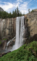
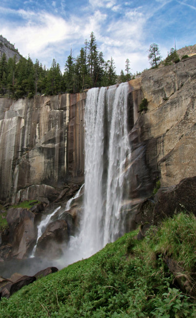
Vernal Fall at 340 cfs

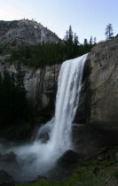
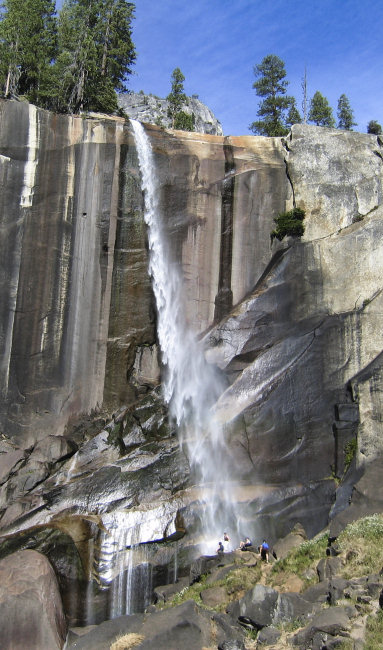
Vernal Fall at 550 cfs

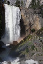
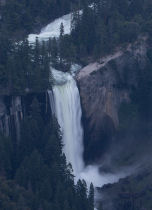
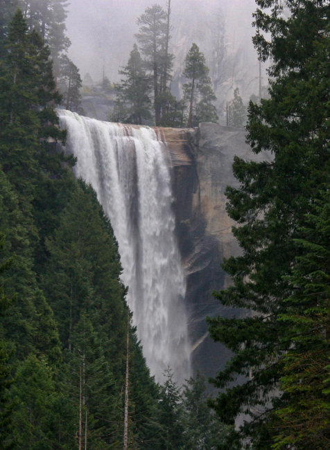
Vernal Fall at 2,000 cfs

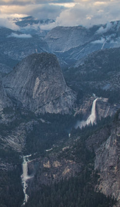
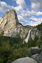
Nevada Fall at 2,000 cfs

Vernal Fall at 3,000 cfs