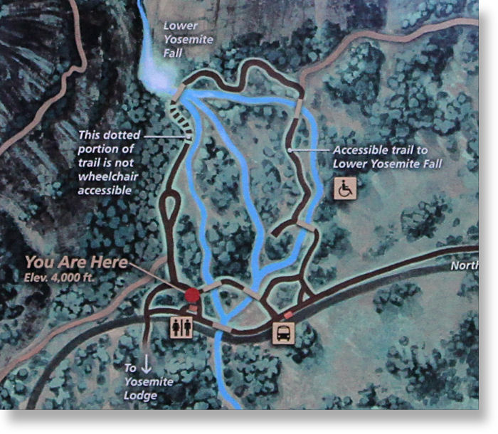
Lower Yosemite Falls Trail Map
Distance: 0.5 miles (.8 km) round trip from trailhead; 1.5 miles (2.4 km) round trip from Yosemite Village
Elevation at trailhead: 3,967 feet (1,347 meters)
Elevation Gain: very little
The famous westernmost approach is shown in red; the blue route, rated as wheelchair accessible, wanders through the woods and emerges again near the main trailhead. A branch off the blue route skirts the very edge of the valley and returns to the road between Yosemite Village and the Ahwahnee Hotel, climbing a hundred feet or so and may give you the mistaken impression that it's about to lead you all the way to the valley rim.
The Upper Yosemite Falls trail winds uphill to the northwest of the lower falls trail, and at one point a short detour leads to a view looking down on the lower falls overlook. So when you're at the bridge at the end of the lower falls trail, keep in mind that someone could be watching you. Besides the dozens of other people already there, of course.
Here's a photo of the map on display at the trailhead: